
Zarrin Tasneem
Geospatial Scientist| LiDAR & Remote Sensing | GeoAI


ABOUT ME
Zarrin has received her Bachelors of Environmental Studies degree in Honours Geomatics from the University of Waterloo where she has learned various course related to geospatial analysis. With 12 years of work experience in the remote sensing industry, she specializes in analyzing Earth observation data using LiDAR, satellite imagery, and machine learning to better understand environmental systems and spatial patterns.Her experience with Teledyne Optech and Hexagon Geosystems gave her the opportunity to apply her knowledge of geospatial analysis in the real world of application. As a true professional, she is capable of applying her knowledge and skills towards the various areas of geospatial analysis.
Outside of work I enjoy fitness, international travel, cooking, painting, reading, exploring new cuisines, learning about different cultures, and histories and language learning.
Throughout my career, I have worked with a variety of remote sensing technologies, using geospatial analysis and spatial data science to extract meaningful insights from Earth observation data. My experience includes analyzing LiDAR, satellite imagery, and other geospatial datasets to better understand landscapes, ecosystems, and environmental change. I am especially interested in how advances in remote sensing and data science can improve our ability to monitor the Earth’s surface and support more informed environmental and spatial decision-making.
Relevant Projects:
Flood Risk and Susceptibility for Town Morris in Manitoba
Used SQL and ArcGIS to build a database and Geodatabase of the acquired data, and performed operations to acquire the appropriate information.
Used various tools and analysis approaches such as the multi-criteria analysis and hydrologic model for creation of a 3D model of the flood risk
Digitized images using various tools in ArcGIS in order to outline the solution on the map
Provided suggestions on how to reduce flood risk in the Town of Morris in Manitoba
Sea Ice Analysis and Polar Bear Vulnerability
Used the ENVI software to classify the different sea ice types to better visualize the sea ice types
Used ENVI and another remote sensing software to determine the breakup and freeze up times and to classify the sea ice based on the breakup and freeze up times
Analyzed the reduction in sea ice for the evaluation of increasing polar bear vulnerability.
Applied Remote Sensing
Satellite System Experience:
Sentinel, Planet Labs (Planetscope, Skysat, Tanager), LandSat, MODIS, EnMAP, RapidEye
Manned and Unmanned Aerial Vehicles:
RGB & NIR Orthoimagery
Hyperspectral Imagery
SFM & LiDAR Point Clouds
Image Processing Software Expertise:
ESRI ArcGIS/Pro, QGIS, GRASS GIS, SAGA, Pix4D, Agisoft Photoscan, ENVI / IDL, ERDAS, Python, R
Data Science & Analytics
I have developed advanced skills in statistics and data management through the use of scientific computing languages
Intermediate Analyst in R and Python:
Machine Learning
Time Series Analysis
Computer Vision
Multivariate Regression
Spatial Statistics
Signal Processing
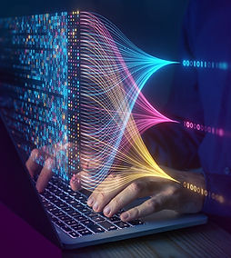
my work has focused on leveraging artificial intelligence and machine learning techniques to advance data science workflows and remote sensing modeling for analyzing complex geospatial data.


Spatial analysis is one of the most powerful approaches for understanding patterns and relationships within both natural and human-built environments. By analyzing spatial data, complex systems and processes can be visualized, quantified, and interpreted to support informed decision-making and scientific discovery.
Software Expertise:
ESRI ArcGIS
QGIS
Global Mapper
Python / GDAL
My primary GIS expertise focuses on raster analysis, particularly for feature classification, extraction, and vectorization using multispectral and hyperspectral imagery. I develop workflows that integrate geospatial data processing with advanced analytical techniques to extract meaningful information from remote sensing datasets.
Remote sensing provides a powerful framework for observing and understanding the Earth’s surface by capturing information across multiple spectral and spatial scales. By analyzing data collected from airborne and satellite sensors, it becomes possible to monitor environmental processes, detect change over time, and extract meaningful patterns from large and complex geospatial datasets.
I began working in remote sensing well before LiDAR became widely adopted, developing early experience in processing and analyzing remotely sensed imagery for environmental and geospatial applications. This background provided a strong foundation in interpreting spectral information and building analytical workflows for large-scale Earth observation data.
My expertise includes working with multispectral, hyperspectral, and satellite imagery for feature detection, land cover classification, environmental monitoring, and spatial analysis, combining remote sensing techniques with GIS and data science tools to derive actionable insights from Earth observation data.
Programming plays a central role in modern geospatial and data-driven research, enabling the automation of complex workflows, large-scale data processing, and the development of analytical tools for spatial and environmental analysis. Through programming, large and heterogeneous datasets can be efficiently processed, analyzed, and transformed into meaningful insights.
My programming experience focuses on building data processing pipelines, geospatial analysis tools, and machine learning workflows for environmental and spatial data. I regularly use programming to automate geospatial tasks, integrate diverse datasets, and develop reproducible analytical frameworks for research and applied projects.
Programming Languages and Tools:
Python
R
SQL
MATLAB
Java Script
GDAL / Rasterio / Geospatial Python libraries
I primarily apply programming to geospatial data processing, remote sensing analysis, spatial statistics, machine learning, and large-scale data analytics, enabling efficient analysis of complex Earth observation and environmental datasets.

Places that I have worked

SKILLS


CONTACT ME
